


Chester-Franklin precinct, Lake County, South Dakota
About
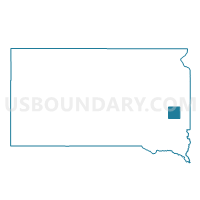
Outline

Summary
| Unique Area Identifier | 667441 |
| Name | Chester-Franklin precinct |
| County | Lake County |
| State | South Dakota |
| Area (square miles) | 71.99 |
| Land Area (square miles) | 69.47 |
| Water Area (square miles) | 2.51 |
| % of Land Area | 96.51 |
| % of Water Area | 3.49 |
| Latitude of the Internal Point | 43.89895710 |
| Longtitude of the Internal Point | -96.99912690 |
Maps


Graphs
Select a template below for downloading or customizing gragh for Chester-Franklin precinct, Lake County, South Dakota


Neighbors
Neighoring Voting District (by Name) Neighboring Voting District on the Map
- Farmington-LeRoy-Clarno-Orland precinct, Lake County, SD
- Herman-Winfred precinct, Lake County, SD
- Lakeview precinct, Lake County, SD
- VTD VP13, Minnehaha County, SD
- VTD-precinct 1, McCook County, SD
- VTD-precinct 3, Moody County, SD
- VTD-precinct 5, Moody County, SD
- Wentworth-Rutland-Wentworth Village precinct, Lake County, SD
Top 10 Neighboring County Subdivision (by Population) Neighboring County Subdivision on the Map
- Lake View township, Lake County, SD (732)
- Chester township, Lake County, SD (709)
- Herman township, Lake County, SD (624)
- Wentworth township, Lake County, SD (396)
- Burk township, Minnehaha County, SD (383)
- Taopi township, Minnehaha County, SD (330)
- Franklin township, Lake County, SD (307)
- Lynn township, Moody County, SD (287)
- Ramsey township, McCook County, SD (229)
- Buffalo township, Minnehaha County, SD (212)
Top 10 Neighboring Place (by Population) Neighboring Place on the Map
Top 10 Neighboring Unified School District (by Population) Neighboring Unified School District on the Map
- Madison Central School District 39-2, SD (8,762)
- Dell Rapids School District 49-3, SD (5,508)
- Tri-Valley School District 49-6, SD (5,024)
- Chester School District 39-1, SD (1,692)
- Colman-Egan School District 50-5, SD (1,663)
- Montrose School District 43-2, SD (1,120)
Top 10 Neighboring State Legislative District Lower Chamber (by Population) Neighboring State Legislative District Lower Chamber on the Map
- State House District 25, SD (22,548)
- State House District 8, SD (20,647)
- State House District 4, SD (20,558)
Top 10 Neighboring State Legislative District Upper Chamber (by Population) Neighboring State Legislative District Upper Chamber on the Map
- State Senate District 25, SD (22,548)
- State Senate District 8, SD (20,647)
- State Senate District 4, SD (20,558)
Top 10 Neighboring 111th Congressional District (by Population) Neighboring 111th Congressional District on the Map
Top 10 Neighboring Census Tract (by Population) Neighboring Census Tract on the Map
- Census Tract 9596, Moody County, SD (3,313)
- Census Tract 9646, McCook County, SD (3,213)
- Census Tract 102, Minnehaha County, SD (2,712)
- Census Tract 9601, Lake County, SD (2,337)
- Census Tract 9603, Lake County, SD (2,253)
Top 10 Neighboring 5-Digit ZIP Code Tabulation Area (by Population) Neighboring 5-Digit ZIP Code Tabulation Area on the Map
- 57042, SD (8,415)
- 57022, SD (4,996)
- 57018, SD (1,372)
- 57017, SD (1,340)
- 57048, SD (1,170)
- 57075, SD (893)
- 57016, SD (693)